字體:小 中 大
 |
|
|
|
| 2010/11/08 00:42:31瀏覽736|回應0|推薦3 | |
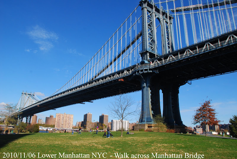
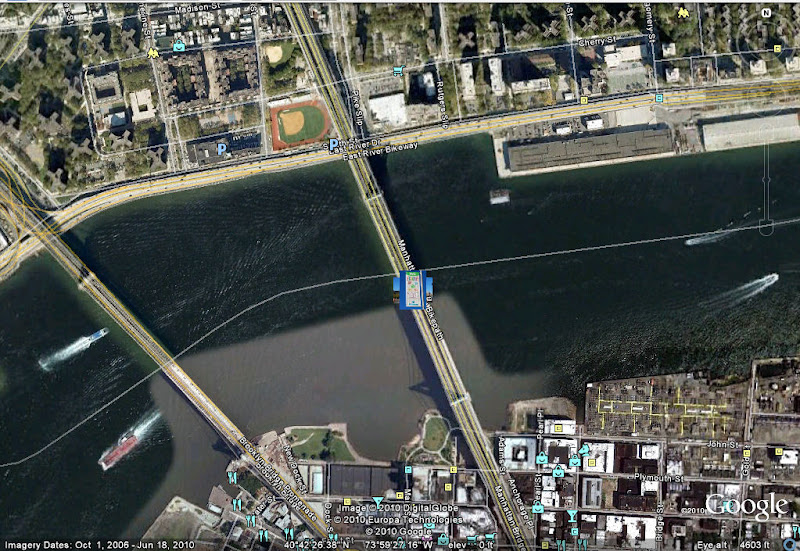
Walk across NYC Manhattan Bridge The Manhattan Bridge is a suspension bridge that crosses the East River in New York City, connecting Lower Manhattan (at Canal Street) with Brooklyn (at Flatbush Avenue Extension). It was the last of the three suspension bridges built across the lower East River, following the Brooklyn and the Williamsburg bridges. The bridge was opened to traffic on December 31, 109 and was designed by Leon Moisseiff,[1] who later designed the infamous original Tacoma Narrows Bridge that opened and collapsed in 1940. It has four vehicle lanes on the upper level (split between two roadways). The lower level has three lanes, four subway tracks, a walkway and a bikeway. The upper level, originally used for streetcars, has two lanes in each direction, and the lower level is one-way and has three lanes in peak direction. It once carried New York State Route 27 and later was planned to carry Interstate 478. No tolls are charged for motor vehicles to use the Manhattan Bridge. The original pedestrian walkway on the south side of the bridge was reopened after forty years in June 2001.[4] It was also used by bicycles until late summer 2004, when a dedicated bicycle path was opened on the north side of the bridge, and again in 2007 while the bike lane was used for truck access during repairs to the lower motor roadway. * Main span: 1,470 ft (448 m) The neighborhood near the bridge on the Brooklyn side, once known as Fulton Landing has been gentrified and is called DUMBO, an acronym for Down Under the Manhattan Bridge Overpass.
Click here to view in Google Earth |
|
| ( 休閒生活|旅人手札 ) |