字體:小 中 大
 |
|
|
|
| 2010/11/02 10:46:32瀏覽631|回應0|推薦4 | |
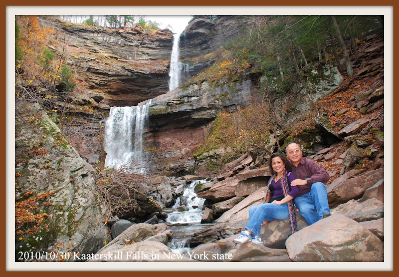
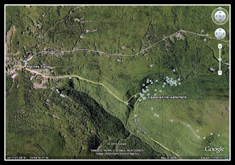
Kaaterskill Falls, NY web: http://www.angelfire.com/ny4/waterfalls/kaaterskillfalls2.html Kaaterskill Falls is a two-drop waterfall located near in the eastern Catskill Mountains of New York, on the north side of Kaaterskill Clove, between the hamlets of Haines Falls and Palenville in Greene County's Town of Hunter. The dual cascades total 260 feet (79 m) in height, making it one of the higher waterfalls in New York, and one of the Eastern United States' taller waterfalls. The falls are one of America's oldest tourist attractions, with it appearing in some of the most prominent books, essays, poems and paintings of the early 19th century. Long before Alexis de Tocqueville's famous essay on America, Kaaterskill Falls was lauded as a place where a traveler could see a wilder image, a sort of primeval Eden. Beginning with Thomas Cole's first visit in 1825, they became an icon subject for painters of the Hudson River School, setting the wilderness ideal for American landscape painting. The Falls also inspired "Catterskill Falls", a poem by William Cullen Bryant. The trail to Kaaterskill Falls is located on NYS route 23A, near Palenville and Haines Falls (NY 23A is most easily reached from Thruway - I-87 - exit 21). Traveling from east to west, 3.4 miles from the intersection of NY 23A and NY 32A in Palenville, is Bastion Falls and the start of the Kaaterskill Falls Trail at a bridge. Parking is 0.2 miles further ahead, on the left (south) side of the road. This point is 1.3 miles from the intersection of NY 23A and North Lake Rd. (Greene County Rt. 18). From the parking area, walk back to the trailhead at Bastion Falls. This takes less than five minutes; be careful for cars. The trail starts somewhat steeply along the stream. Small waterfalls are passed at the start, and are definitely worth checking out for pictures. Then, the grade eases, with the trail mostly staying near the stream. Some areas along Kaaterskill Creek are indeed very beautiful. The way is fairly rocky and eroded. Soon, the water is not as close for a distance, but when the trail returns to it, you are at Kaaterskill Falls. The trail officially ends at this point.
web: http://picasaweb.google.com/lh/albumMap?uname=JCCHuang51&aid=5534729552362602897#map |
|
| ( | ) |