https://youtu.be/XCox5HNMomc?si=g85ebdqhS36PEB4e
.
| Pinglu Canal | |
|---|---|

Interactive map of Pinglu Canal
| |
| Location | Guangxi |
| Country | China |
| Specifications | |
| Length | 134.2 km (83.4 miles) |
| Maximum boat beam | 15.8 metres (52 ft) |
| Maximum boat draft | 5 metres (16 ft) |
| Locks | 3 |
| Maximum height above sea level | 65 |
| History | |
| Construction began | August 2022 |
| Date completed | December 2026 (planned) |
| Geography | |
| Start point | Xijin reservoir, Hengzhou, Guangxi |
| End point | Qinzhou (Gulf of Tonkin) |
 時隔千餘年 中國再增新運河:廣西「平陸運河」全線通水.全長134.2公里,北起廣西橫州市平塘江口,經靈山縣陸屋鎮,沿欽江進入北部灣的「平陸運河」,20260603日上午全線通水。
平陸運河建成後將成為中國西南地區最短出海通道,5,000噸級江海直達船可從西江內河港口直通中國沿海港口和東南亞主要港口,較從廣州出海航程縮短560公里,估計每年可節省運輸成本餘人民幣52億元。.
. .
.
 .
.
「平陸運河」是中國在廣西壯族自治區興建的世紀級水運工程,起於南寧橫州市西津水庫平塘江口,跨分水嶺經欽州靈山縣,沿欽江匯入北部灣欽州港。全長 134.2 公里,耗資約 727 億人民幣,是中國隋朝自京杭大運河後 1,000 多年來首條連通江海的大型運河。
該運河於 2022 年動工,並於 2026 年 6 月初實現全線通水,預計同年 9 月正式通航。
.關鍵工程亮點與規格
 .
.
The mega-project will provide China’s landlocked southwestern provinces with direct access to global shipping lanes, making it faster and cheaper to transport goods between the Chinese interior and neighbouring countries.

區域發展: 被視為西部陸海新通道的骨幹工程,能串聯長江經濟帶與海上絲綢之路,進一步帶動廣西及周邊省份的「向海經濟」發展。
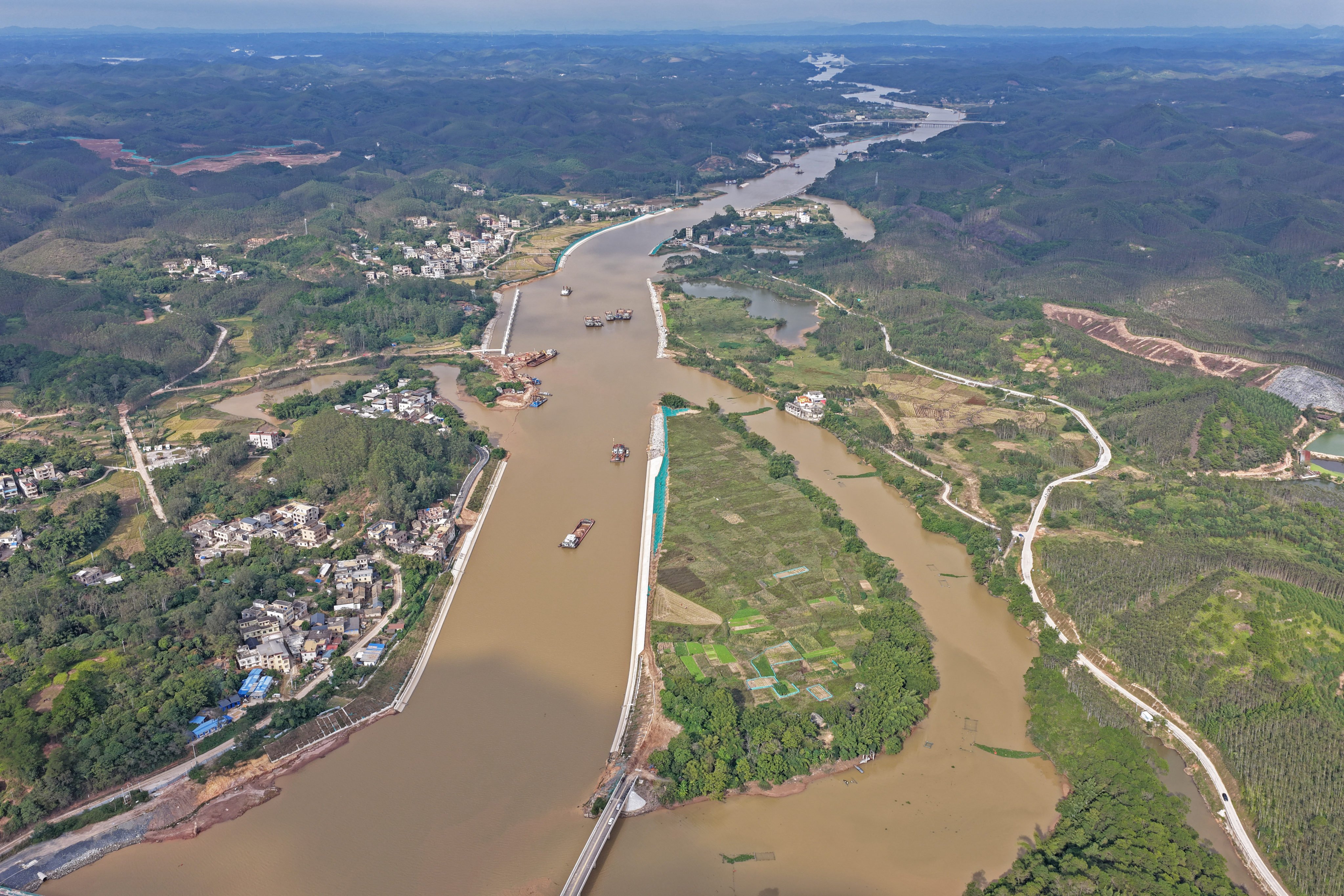
The Pinglu Canal, the first river-to-sea canal built since the founding of the Peoples Republic of China, is nearing completion after over three years of intensive construction. As a backbone project of the New International Land-Sea Trade Corridor in western China, the canal spans 134.2 kilometers, linking the Pingtang River estuary in Nanning, Guangxi Zhuang autonomous region, to the Beibu Gulf via the Qinjiang River.
Today, the canals channel has largely taken shape. Towering sluice hubs line its banks, and its wide, sunlit waterway -- stretching over 100 meters in width -- quietly channels water toward the sea, signaling a transformative shift in regional connectivity.
A strategic link in the Chinese national infrastructure
A close look at the map of China reveals an intricate network of rivers crisscrossing Guangxi -- from west to east, the Xijiang, Hongshui, Qianjiang, and Guijiang Rivers meander like the veins of a phoenix tree leaf. The Pinglu Canal serves as the vital petiole connecting this inland network to the sea, functioning as a "lifeline" for waterborne transport in the region.
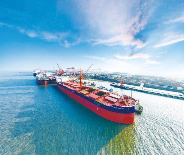
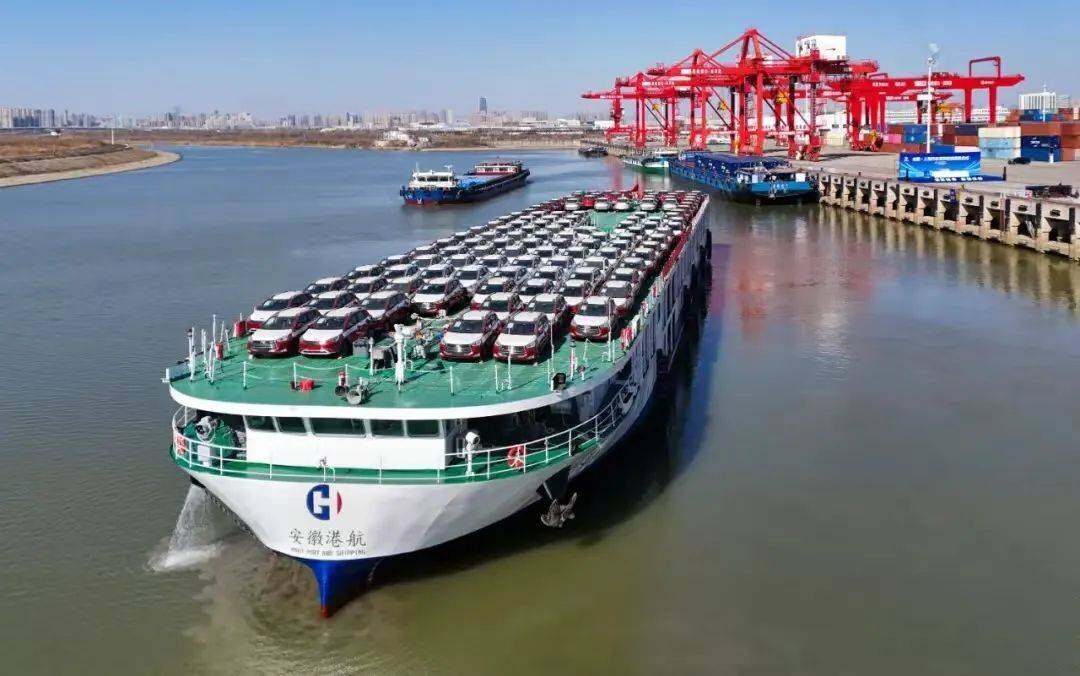
The canal integrates with the Xijiang shipping trunk line upstream, extending westward via the Zuojiang and Youjiang Rivers into Yunnan, eastward through the Yujiang River to the Guangdong-Hong Kong-Macao Greater Bay Area, and northward via the Qianjiang and Hongshui Rivers into Guizhou. To the south, it opens into the Beibu Gulf, establishing a direct inland waterway to the sea. Designed as a Class I inland waterway, the Pinglu Canal will accommodate 5,000-ton vessels, enabling seamless connectivity between inland provinces and global maritime trade routes.
Despite its coastal geography, Guangxis rivers historically flow eastward into the Pearl River Delta due to complex topography and elevation differences, leaving the region without a direct river-to-sea route. As a result, goods from western China have traditionally faced extended transport routes to reach international ports.
"Inland waterway transport offers substantial advantages over rail and road. It handles higher cargo volumes, lower costs, and reduced emissions, making it a critical element in optimizing Chinas transport infrastructure," said Yan Qiang, director of the science and technology information department at the Pinglu Canal Group.
Yan emphasized that the canals construction is driven by its significant and unique strategic value. "Once operational, it will greatly enhance the efficiency of trade between Guangxi, southwestern China, ASEAN, and beyond. Compared with the route through Guangzhou Port, the canal will shorten the journey by over 560 kilometers and save more than 5.2 billion yuan (approximately $731 million) in annual freight costs."
Engineering marvel with multifunctional benefits
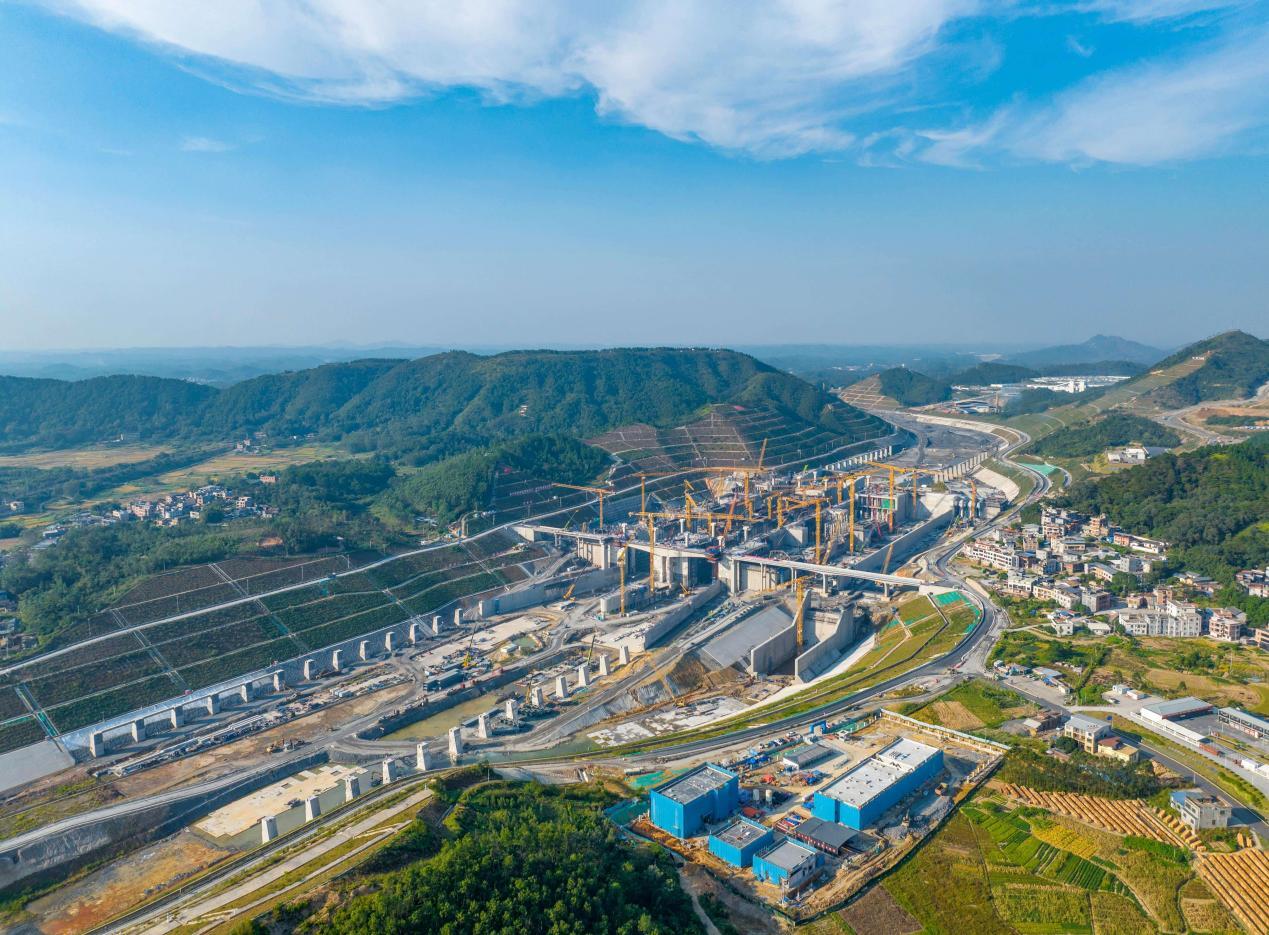
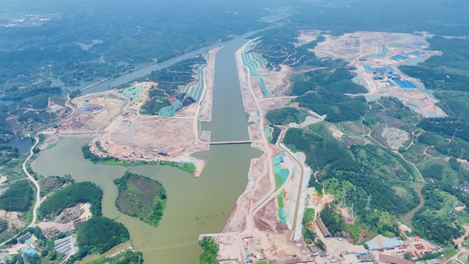
The project encompasses the construction of a 134.2-kilometer-long, 5,000-ton-class inland waterway, three double-lane ship lock hubs, 27 newly built or reconstructed bridges, and supporting facilities.
"Unlike the Suez or Panama Canals, the Pinglu Canal is designed as a modern, multifunctional waterway that integrates navigation, flood control, water supply, irrigation, and ecological preservation," explained Yan. "Constructing such a complex system under tight deadlines, within challenging terrain and strict environmental constraints, has been a formidable engineering challenge."
Inside the projects central command and control center, two real-time metrics that reflect the scale of construction progress: earth and rock excavation, and concrete volume poured.
To carve the canals path through mountainous terrain, excavation has reached 315 million cubic meters -- nearly triple the volume excavated for the Three Gorges Project. Simultaneously, concrete pouring for the canals three cascade ship lock hubs -- Madao, Qishi, and Qingnian -- has reached 5.84 million cubic meters, enough to fill more than 2,300 standard swimming pools. These locks collectively manage a water level drop of approximately 65 meters, essential for vessel navigation.
"As of now, over 97 percent of the channel excavation has been completed, 80 percent of the banks have been reinforced, and water has been introduced to an initial 18-kilometer section," said Mo Rixiong, project manager at CCCC Guangzhou Dredging Co., Ltd., noting that the project has entered its final phase..