 字體:小 中 大
 |
|
|
|
| 2022/04/19 18:08:16瀏覽706|回應0|推薦11 | |
..
.
China has invested considerably in advancing its capabilities for strategic situational awareness as part of its sweeping overall military modernization program. The country’s LPARs are an integral part of China’s early-warning, missile-defense and space-tracking network, which also includes a growing number of space-based sensors and a network of over-the-horizon radar.
 . .The February 2022 image shows a new radar panel added to an existing early-warning sensor in Chinas eastern Shandong province
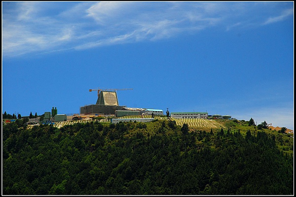
中國軍方在山東省興建早期長程預警雷達站,用來偵測美國駐軍日本的情報,.這樣一來如同美國在台灣省新竹的早期長程預警雷達站,是同樣性質的監測系統,但是北約軍事觀察家分析認為,台灣省新竹的早期長程預警雷達站,完全由美軍掌管,台灣方面無權涉足,但是中國山東省興建早期長程預警雷達站,所偵測到駐日本美軍(空軍)的動態,要提前3分鐘左右,換句話說中國可以先發制人,但是台灣省新竹的早期長程預警雷達站的情報,卻要求傳輸到日本及關島進行研判才能下達作戰指令,因此在時間的先機上,中國軍隊可以提前準備應戰.由此看來中國取得戰爭的勝利成功的機率是80%.以上.
A satellite photo has revealed that China has built a new long-range, early-warning radar that can be used to detect ballistic missiles from thousands of miles away, likely giving it coverage of all of Japan. The image, taken on February 2022 by commercial satellite imagery company Maxar Technologies and published on Google Earth, show that a new Large Phased Array Radar, or LPAR, has been built at an existing mountaintop site in Yiyuan County, Shandong Province, some 70 miles southeast of the provincial capital Jinan. The new array is pointed in a northeasterly direction and was built sometime after November 2019. Its completion can potentially give China early warning of ballistic missile launches from North and South Korea, most of Japan and even parts of Russia’s Far East. The first LPAR at the site, located at 36°01′30″ N, 118°05′31″ E, is some 2,300 feet above sea level. It was finished sometime in 2013-2014 according to Google Earth’s historical imagery and is oriented toward the south-southeast, almost certainly to provide radar coverage of Taiwan. China is also known to operate additional LPAR sites at Lin’an in Zhejiang Province and Heilongjiang Province. These sites enable early warning coverage of Japan, the Korean Peninsula and Taiwan from multiple angles. Another site at Korla in Xinjiang Province provides early warning coverage of India. In addition to providing warning against ballistic missile launches, LPARs can also be used for satellite tracking and general space surveillance. The capabilities of the Chinese LPARs are not known, although the beam of the similar AN/FPS-115 radar found in the U.S. Pave Paws network can be deflected up to 60 degrees from the array’s central boresight axis, allowing each array to cover an azimuth angle of 120 degrees. Previously released photos of China’s LPARs show that the array is also sloped, similar to that of the AN/FPS-115 which is sloped at an angle of 20 degrees, allowing the beam to be directed at any elevation angle between 3 degrees and 85 degrees. The range of the Pave Paws radar network has not been officially published, although Encyclopedia Britannica says that the system “is supposed to detect targets with a radar cross section of 10 square meters at a range of 3,000 nautical miles (5,600 km)”. China has invested considerably in advancing its capabilities for strategic situational awareness as part of its sweeping overall military modernization program. The country’s LPARs are an integral part of China’s early-warning, missile-defense and space-tracking network, which also includes a growing number of space-based sensors and a network of over-the-horizon radars.. . .台灣及日本的早期長程預警雷達站都由美軍掌管使用.
|
|
| ( 時事評論|國防軍事 ) |


